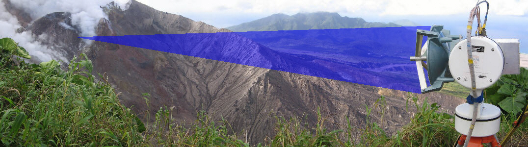
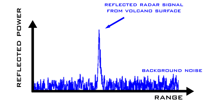
AVTIS - 'seeing' the volcano
Who are we?
The workshop and exhibition
Resources and information
St Andrews <
Medical
Volcanos
Hiper

Imaging <
The Basics
Active
Passive

Applications <
The Universe
Security
Brijot Imager
Clouds
Medical
Fusion
Military
Car Radar
Debris Detection
Aircraft Landing
External links
Photo gallery


In this section:

> 1. Intro
> 2. The Instrument
> 3. The Antenna
> 4. As a Radar
> 5. Seeing the Volcano
> 6. Measuring
> 7. Data Stacking
> 8. A Scan
> 9. Colour Code
> 10. The Volcano
> 11. Pyroclastic Flows
> 12. Devastation
> 13. The Future

AVTIS uses its antenna to beam a tightly focussed radar signal at the mountain. This beam can be used to measure the distance to the volcano. You can think of the beam as a mm-wave searchlight which illuminates a small spot on the mountainside. The radar beam is half a degree wide so the spot is only a few metres across even at several kilometres range.

When the radar signal is reflected from the spot on the volcano AVTIS 'sees' the reflection in a measurement called a radar range spectrum:


'Vision For The Future' is an EPSRC funded project run by the MMW group at the University of St Andrews
Copyright ©2006 by the University of St Andrews :: web, graphic and exhibition design by FifeX Ltd, www.fifex.co.uk