AVTIS is measuring!
Who are we?
The workshop and exhibition
Resources and information
St Andrews <
Medical
Volcanos
Hiper

Imaging <
The Basics
Active
Passive

Applications <
The Universe
Security
Brijot Imager
Clouds
Medical
Fusion
Military
Car Radar
Debris Detection
Aircraft Landing
External links
Photo gallery


In this section:

> 1. Intro
> 2. The Instrument
> 3. The Antenna
> 4. As a Radar
> 5. Seeing the Volcano
> 6. Measuring
> 7. Data Stacking
> 8. A Scan
> 9. Colour Code
> 10. The Volcano
> 11. Pyroclastic Flows
> 12. Devastation
> 13. The Future

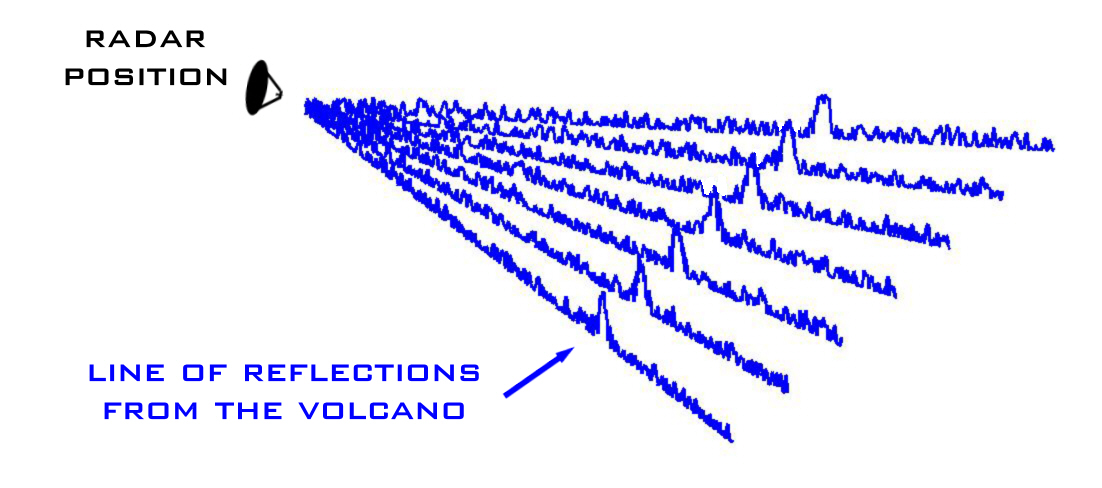
The spectrum show how much of the radar signal is reflected at each 85cm step in distance away from the radar so it is very sensitive. You can see here how the reflection from the volcano shows up as a sharp spike rising out of the background 'noise'.

So the basic measurement that AVTIS makes is the distance to a single illuminated spot on the side of the volcano. To build up a larger picture of the lava dome, the antenna is rotated sideways very slightly and a new range spectrum is recorded. This process is repeated and with each new measurement a different peak in reflection shows the distance to different parts of the volcano.


'Vision For The Future' is an EPSRC funded project run by the MMW group at the University of St Andrews
Copyright ©2006 by the University of St Andrews :: web, graphic and exhibition design by FifeX Ltd, www.fifex.co.uk