|
|
|
|
|
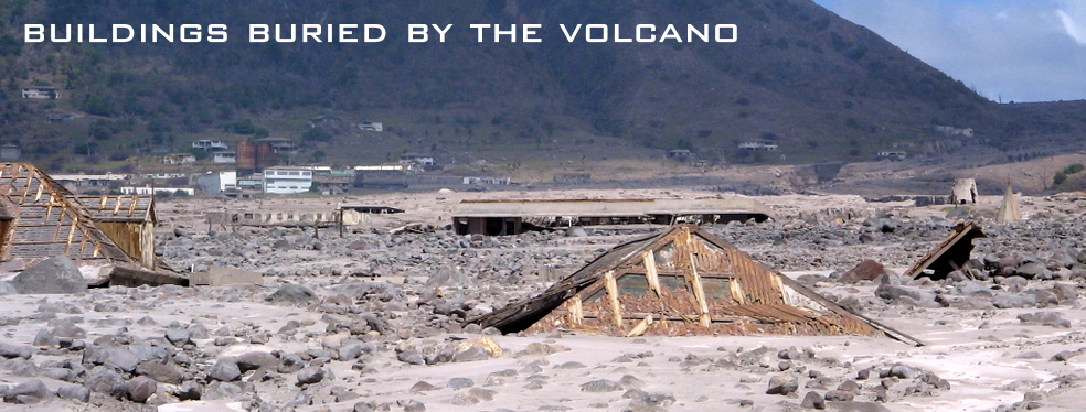
Measuring only 27 x 13 miles (17 x 8 km), the eruption
of the Soufrière Hills volcano forced the people of Montserrat
to abandon the capital city of Plymouth and relocate to the
northern end of the island. The volcano became active in 1995
and many of the original population of 10,500 were evacuated
from the flanks of the volcano, not just to avoid the immediate
danger from pyroclastic flows but also to escape dangerous
mudflows called lahars: when heavy rain mixes with the ash
from previous eruptions the resulting mudflows can be torrential,
burying houses and setting like concrete.
By 1997, Bramble airport on the east of the
island was also forced to close, and the following year the
population fell to just 3000 with many of the residents emigrating
to the UK and the US. Since then Montserrat has rebuilt its
infrastructure in the north of the island, constructing a
new airport and building new housing and by 2006 the population
had recovered to around 9,500 although the southern half of
the island is now designated as an exclusion zone, off limits
to the general public.
|
|
|
|
|
|